Trying to decide if your yacht belongs in Las Olas Isles or Pompano? You are weighing more than a dock. You are choosing run times to open ocean, bridge logistics, service access, and the daily rhythm that fits your lifestyle. This guide breaks down ocean access, marina ecosystems, neighborhood feel, and which setup suits different boats. Let’s dive in.
Quick take: how they differ
Las Olas Isles delivers a luxury, boulevard-adjacent lifestyle with quick ICW access to Port Everglades. For many docks, the ocean run is commonly reported around 2–4 nautical miles via the ICW to the inlet approach, with timing shaped by slow zones and any bridge waits. That proximity plus Fort Lauderdale’s yacht service cluster is a major advantage for larger vessels and owners who want full-service convenience. Local yacht access guides outline typical routes and bridge considerations.
Pompano centers on Hillsboro Inlet and a dense network of sportfishing-friendly marinas. Many facilities sit within a few nautical miles of the inlet, and some near-inlet docks are well under a mile, which can mean minutes to the Atlantic depending on conditions. The vibe is marina-centric and practical, with bait, fuel, and charter activity close at hand. For quick offshore runs and fishing, Pompano’s setup is tough to beat. You can scan a range of local marinas with HarbourMaps’ Pompano listings.
Ocean access and run times
Exact distances and minutes depend on your specific dock or slip, vessel speed, slow/no‑wake zones, and bridge openings. Always verify your route on NOAA charts and confirm measured depth at the slip and along the channel. The links below help you plan like a captain.
Las Olas Isles to Port Everglades
From a central Las Olas dock, it is commonly reported as roughly 2–4 nautical miles to the Port Everglades approach along the ICW. That often translates to a single‑digit to low‑two‑digit minute run at planing speeds once you clear slow zones. Air draft matters on certain routes; the 17th Street Causeway (Clay E. Shaw Bridge) follows scheduled openings that can add a few minutes. Review opening rules via the USCG drawbridge regulations for Fort Lauderdale, and remember Port Everglades is a maintained commercial channel, with dredging documented in federal reports like the EPA’s Port Everglades assessment.
Pompano to Hillsboro Inlet
Pompano’s marinas cluster near Hillsboro Inlet, the area’s local ocean gateway. Many slips are within a few nautical miles, and marinas adjacent to the inlet can reach open water in minutes, conditions permitting. For planning and coordinates, see NOAA’s Hillsboro Inlet bench mark page. Inlets can shoal seasonally, so confirm recent soundings with the marina and plan around tide, draft, and sea state.
Marina ecosystems and services
Fort Lauderdale cluster (Las Olas area)
Fort Lauderdale is a full-service yachting hub with slips for large vessels, high‑speed fueling, and serious refit capacity. Las Olas Marina, Pier Sixty‑Six, Bahia Mar, and the broader Lauderdale Marine Center ecosystem support haul‑out, refit, and crew services. Explore slip and amenity details at Las Olas Marina and the city’s yacht‑service initiative, FLL Fueled by Water. You will also find a deep directory of nearby repair, fuel, and provisioning options around Port Everglades via Waterway Guide’s service listings.
Pompano’s marina network
Pompano’s facilities are numerous and practical, with a heavy sportfishing orientation: live bait, fuel docks, tackle, and day-charter bases are common. Popular hubs like Sands Harbor Marina and area service yards keep turnaround times short for offshore trips. A quick scan of Pompano’s marinas shows how close many slips are to the inlet, which can be a meaningful advantage if you fish frequently.
Neighborhood vibe and dockage styles
Las Olas Isles
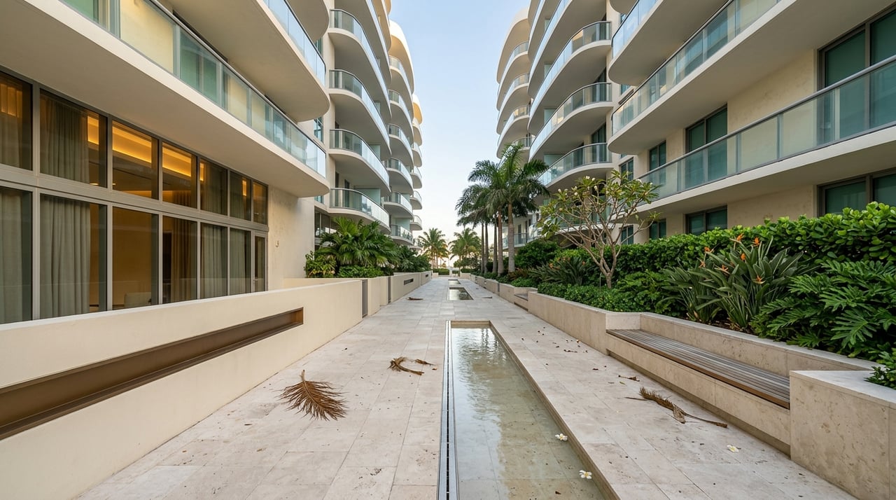
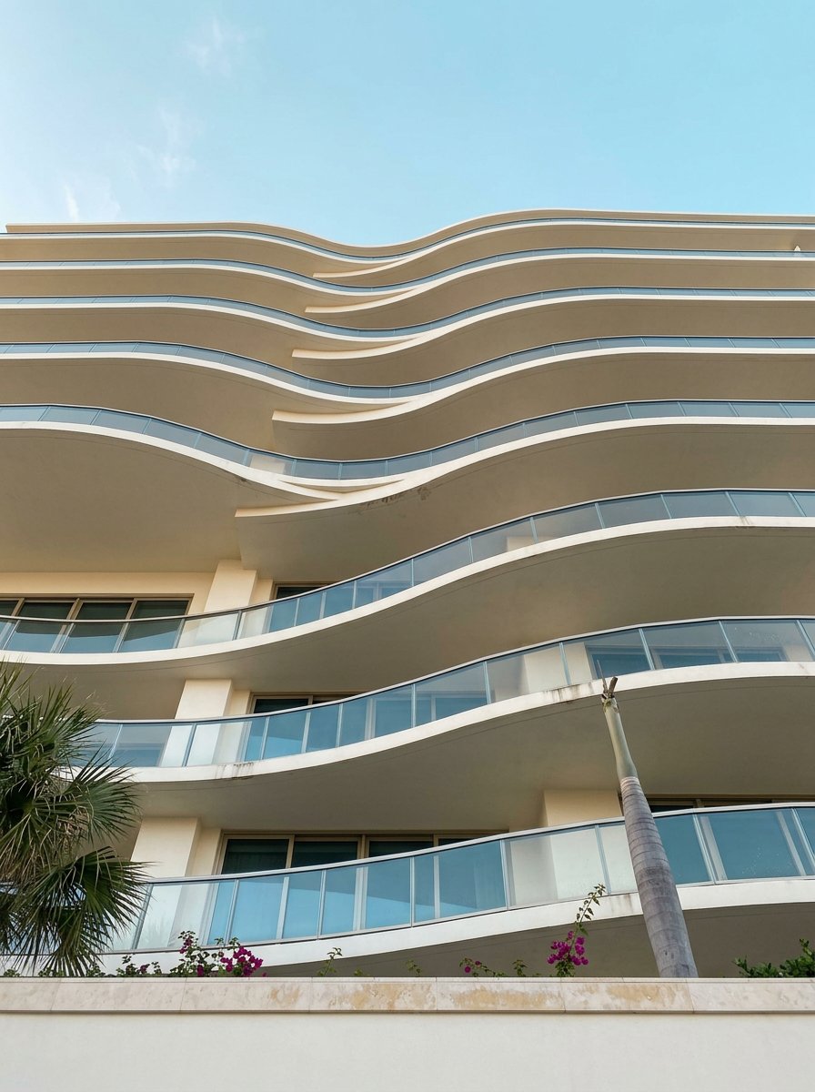
The Isles are finger‑island neighborhoods connected to Las Olas Boulevard and close to Fort Lauderdale Beach. You will find luxury single‑family waterfront homes, select townhomes, and low‑rise condo pockets, often with deeded docks. The appeal is the blend of upscale, walkable city life with direct water access and short runs to Port Everglades. Canal geometry varies by isle; wider, deeper channels support larger yachts and easier turning.
Pompano Beach
Pompano offers a mix of older canal homes, mid‑rise beachfront condos, and marina‑centric living near the inlet. Price points and housing types are more varied than the tighter luxury band you see in Las Olas Isles. Many point lots and broader canals handle large sportfishing boats comfortably, but, as always, depth and turning room are property specific. Local guides on canal widths and waterfront setbacks, such as this overview of South Florida canal considerations, can help frame your due diligence.
Which fits your boat and lifestyle
- Weekend cruiser, 30–50 ft: Either works. Choose Las Olas if you want a walkable, restaurant‑rich scene and short city cruises. Pick Pompano if fast offshore runs and a marina‑forward setup matter more. See representative Las Olas routes and clearances in this yacht access guide.
- Serious sportfisher, 40–90 ft: Pompano’s near‑inlet marinas and sportfishing infrastructure save time to the reef and Gulf Stream. Select deeper, wider Las Olas canals can still fit the bill if you want a boulevard‑adjacent lifestyle.
- 80 ft+ motor yacht or trawler: Las Olas and the Port Everglades area win on service density, haul‑out, and refit scale. Fort Lauderdale’s large‑yacht focus is well documented, including coverage of the Las Olas Marina megayacht development.
- Liveaboard or walkable lifestyle: Las Olas offers easy access to dining, culture, and the beach. Pompano provides a relaxed, marina‑resort rhythm near the inlet. Always confirm liveaboard rules with your marina or association.
How to choose: a practical checklist
- Depth at the dock at MLLW: Get recent soundings from the marina or a surveyor. Federal and port documents discuss dredging programs; start with the EPA’s Port Everglades assessment.
- Air draft and bridge schedules: Match your mast or hardtop height to posted clearances. Review USCG drawbridge opening rules for routes around Las Olas and the New River/ICW.
- Canal width, setbacks, and turning radius: Confirm permitted slip length and practical maneuvering room. This canal and setback guide is a helpful primer.
- Fuel, pump‑out, and haul‑out: Fort Lauderdale has a dense network of large‑yacht services. Start with the city’s FLL Fueled by Water resources to understand capacity nearby.
- Inlet and channel maintenance: Ask about shoaling history and timing of any planned dredging. For Hillsboro Inlet planning, reference NOAA’s station page; for Port Everglades operations, review USCG safety zones and port notices.
Visual route reference
The simple sketches below show the general relationship between docks and ocean access. They are not for navigation. Use your property’s GPS plus NOAA charts to measure your exact route and verify clearances and depths.
Panel A: Las Olas Isles to Port Everglades (South)

[Canal Dock]
     |
     v  (ICW south)
 [17th St Causeway]* ----> [Port Everglades Approach] ----> Atlantic

* Bascule bridge with scheduled openings (check USCG regs)

Panel B: Pompano to Hillsboro Inlet

[Marina/Dock near ICW]
          |
          v  (short run north/south depending on location)
     [Hillsboro Inlet] ----> Atlantic

Proximity varies by marina; some near-inlet docks are under 1/2 nm.
The bottom line
Choose Las Olas Isles if you want a refined, walkable neighborhood with short runs to a maintained inlet and immediate access to large‑yacht services. Choose Pompano if you value near‑inlet slips, fast offshore departures, and a marina‑first lifestyle shaped by sportfishing and practicality. If you are unsure, match your vessel’s draft and air draft to the route, then weigh your day‑to‑day lifestyle against service needs.
If you want a discreet, data‑driven plan tailored to your boat and routine, let’s talk. Connect with Roman Tschannen for a private consultation and a curated shortlist of properties and slips that fit your exact brief.
FAQs
What is the typical run time from Las Olas Isles to the ocean?
- Many central Las Olas docks are about 2–4 nautical miles from the Port Everglades approach via the ICW. Expect a single‑digit to low‑two‑digit minute run once clear of slow zones, plus any drawbridge timing. See this local access guide and confirm with current USCG bridge schedules.
How close are Pompano marinas to Hillsboro Inlet?
- Several marinas are within a few nautical miles, with some near-inlet docks under a mile, which can mean minutes to the Atlantic depending on conditions. For station data and coordinates, reference NOAA’s Hillsboro Inlet page.
Which area has better large‑yacht services and refit capacity?
- Fort Lauderdale’s Port Everglades corridor offers the highest concentration of large‑yacht slips, fueling, haul‑out, and refit facilities in the area. Start with Las Olas Marina and the city’s FLL Fueled by Water resources to gauge capability.
What bridge factors should I consider around Las Olas?
- Air draft and timing. The 17th Street Causeway and other ICW bridges follow posted opening schedules that can affect your departure. Check the USCG drawbridge regulations and confirm current clearances before purchase.
Are inlets like Hillsboro and Port Everglades consistently deep?
- Depths can change with shoaling and maintenance cycles. Port Everglades is a maintained commercial channel documented in federal assessments like this EPA report. Always obtain recent soundings for your slip and check local notices to mariners.
How can I verify a listing’s “minutes to the inlet” claim?
- Use the property’s GPS, plot the route on NOAA charts, and account for slow/no‑wake zones and bridge openings. Confirm measured depth at the dock at MLLW, and review canal widths and setbacks with resources such as this canal and setback primer.